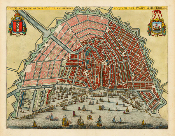
A very interesting 17th-century map of Amsterdam, published by Olfert Dapper in 1663. Dapper needed a simplified and compact version of a current plan of the city for his book Historische Beschryving der Stadt Amsterdam (Historical Description of the City of Amsterdam), which was commissioned by the mayor of Amsterdam, Nicolaes Witsen. Dapper combined two iconic city plans of Amsterdam into one — Joan Blaeu’s 1649 Amstelodami Celeberrimi and Daniel Stalpaert’s 1662 Amstelodami Veteris et Novissimae, engraved and published by Nicolaes Visscher. The result was a smaller, simplified map using Blaeu’s overall layout, and Stalpaert’s plan with the projected urban expansion and new city walls. Map title: Nette Aftekening van d’Oude en Nieuwe Roojingh der Stadt Amsterdam.
• Amsterdam, 1663 city plan, Blaeu, Stalpaert, Dapper (& anonymous engraver)
• Fine Art Premium Giclée (Gouttelette) Print (100% cotton 340 gsm fine art paper)
• Made in USA


