The First Map of the United States Made in America by an American
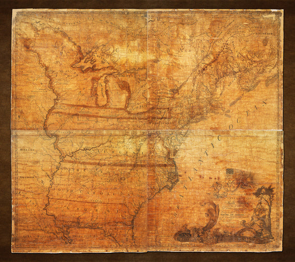
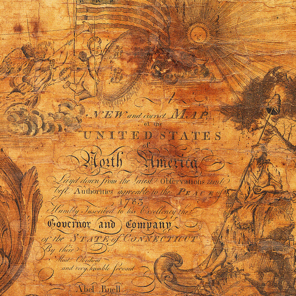
Abel Buell’s 1784 map, “A New and Correct Map of the United States of North America”, was the first ever map of the United States to be made entirely in America, and drawn and printed by an American-born cartographer. Buell, who was a highly skilled engraver from Connecticut, published his momentous creation only six months after the boundaries of the new country were outlined by the Treaty of Paris on September 3, 1783. Abel Buell’s map had other firsts — it was the first map in the United States submitted for copyright; it also showed the “Stars and Stripes” for the first time, in the map’s cartouche featuring the goddess of Liberty. The female figure holds a globe and a scroll in her feet carries the date of the first Independence Day. (In 2010 Mr. David Rubenstein bought at an auction one of only a few copies of the map in existence, for $2.1 million, and generously placed the invaluable document in the stewardship of the Library of Congress in Washington, D.C.)
Full map title: A New and Correct Map of the United States of North America Layd down from the Latest Observations and best Authorities agreeable to the Peace of 1783, Humbly Inscribed to his Excellency the Governor and Company of the State of Connecticut By their Obedient and very humble Servant Abel Buell
A different version of the Abel Buell map is available here.
• Abel Buell’s monumental 1784 map of the United States — America’s first national map (I)
• Fine Art Premium Giclée (Gouttelette) Print (100% cotton 340 gsm textured fine art paper)
• Made in USA


