Savoy, 1682, Tabvla Generalis Sabavdiæ, France, Italy, Switzerland, Blaeu Map (II)
Brand: Battlemaps.us
Tabula Generalis Sabaudiae ~ Theatrum Statuum Sabaudiae Ducis
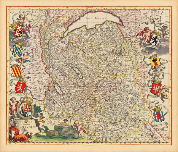
A beautiful, antique map of the Duchy of Savoy in the 1600s by Joan Blaeu. The crown jewel of Blaeu’s townbook Theatrum Sabaudiae, the Savoy map was designed by Giovanni Tommaso Borgonio, based on his 1680 map Carta Generale de Stati di Sua Altezza Reale, and engraved by Johannes De Broen. It was published by Blaeu’s heirs after his death. The map covers the area between Lake Geneva and Dauphiné in the Western Alps and contains an exceptional amount of detail. The layout is adorned with the supported-by-putti coats of arms of Savoy and its districts: Genevois, Faucigny, Beaufort, Chablais, Maurienne, Tarentaise and Bugey (Beugey, Beugeoys). The bottom left corner is occupied by an impressive allegorical cartouche with the map title: Tabula Generalis Sabaudiae (General Map of Savoy), featuring the Arms of the House of Savoy. (A different version of the map is available here. Another important map from Blaeu’s Savoyard atlas — the plan of Nice — can be found here.)
• 17th-century map of the Duchy of Savoy, with coats of arms, 1682, (Borgonio, De Broen), Joan Blaeu & Sons (II)
• Title: Tabula Generalis Sabaudiae / Ioannes Blaeu excudit cum Privilegio Ordinum Hollandiae et Westfrisiae
• Fine Art Premium Giclée (Gouttelette) Print (100% cotton 340 gsm fine art paper)
• Made in USA


