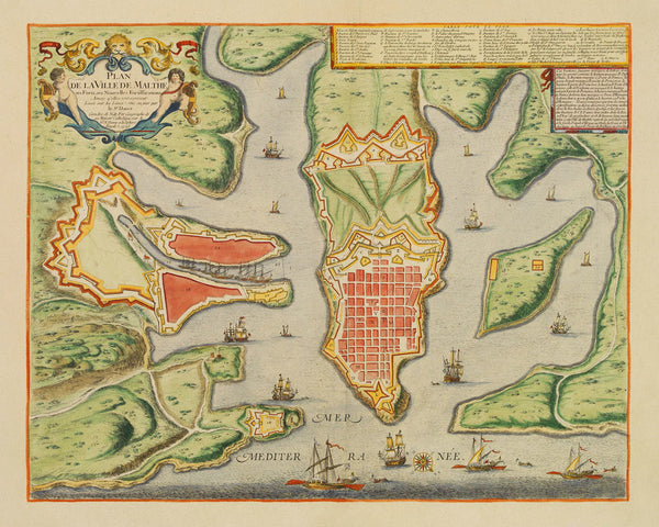
Malta, 1723, Plan de la Ville, Valletta & Harbour, de Fer, Danet, Old Map (I)
Brand: Battlemaps.us
An early-eighteenth-century plan of Valletta and Harbour, and the surrounding area, showing the latest fortifications of the period. The upper right corner contains a key to the principal places of the city with a title ‘Table Povr (Pour) le Plan’. The map was published by Nicolas de Fer first in 1696, and later updated and reissued in 1723 by his successor and son-in-law Guillaume Danet. The main title in the title cartouche reads: Plan de la Ville de Malthe ses Forts, ses Nouvelles Fortiffications Ainsy q'elles sont a present Levée sur les Lieux. Mis au jour par le Sr. Danet… 1723.
• Old map of Valletta, Malta, Plan de la Ville de Malthe, 1723, de Fer / Danet (I)
• Fine Art Premium Giclée (Gouttelette) Print (100% cotton 340 gsm fine art paper)
• Made in USA


