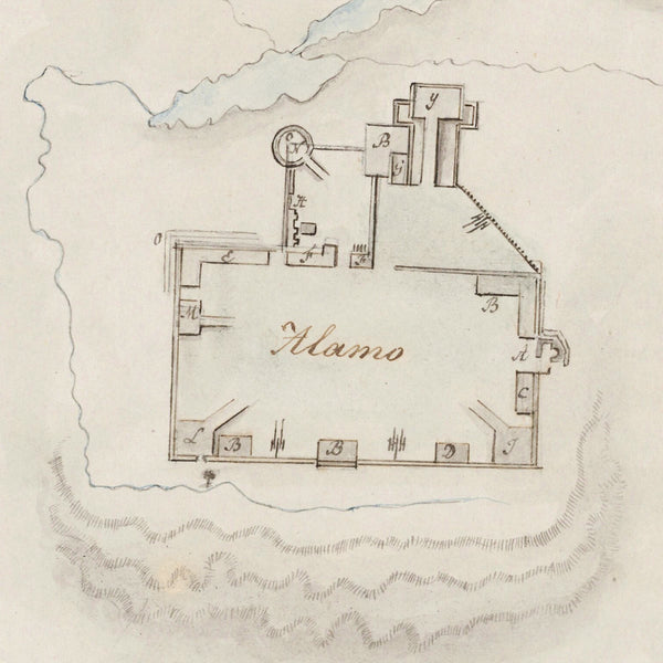
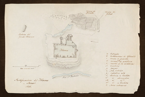
“Fortificacion del Alamo a Bexar”
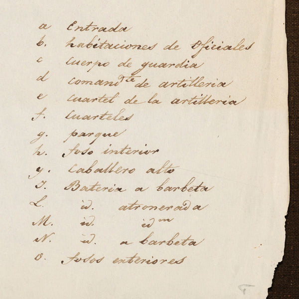
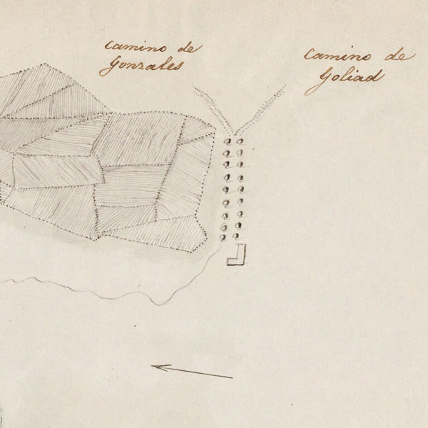
A manuscript plan of the Alamo Mission and surrounding area in 1836, during the Texas Revolution. The sketch was drawn by Jean-Louis Berlandier, a French naturalist and explorer, living in Mexico. The plan, written in Spanish, contains an index with explanations, e.g. “Entrance”, “Batteries”, etc.
• Hand-drawn map of the Alamo, San Antonio de Bexar, Texas, from 1836, by Jean-Louis Berlandier
• Title: Fortificacion del Alamo a Bexar 1836 (Planos topograficos de diferentes fortificaciones)
• Fine Art Premium Giclée (Gouttelette) Print (100% cotton 340 gsm fine art paper)
• Made in USA


