"Damn the torpedoes, full speed ahead!" - Rear Admiral Farragut
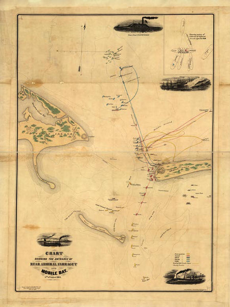
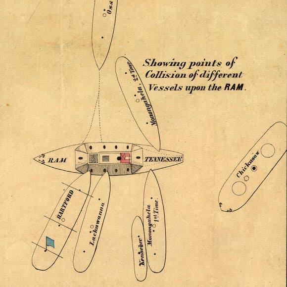
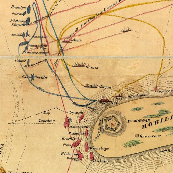
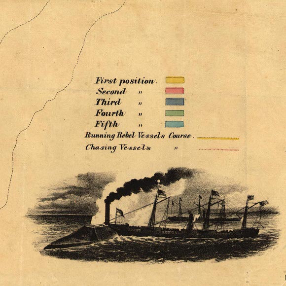
The Chart Showing the Entrance of Rear Admiral Farragut into Mobile Bay, 5th of August 1864 is a detailed historical map depicting the famous Civil War naval battle. Created by Robert Weir and published by Hatch & Co. in 1864, this chart illustrates the strategic movements of Admiral David Glasgow Farragut’s fleet as they navigated through Mobile Bay. With a scale of approximately 1:22,500, the map highlights five key positions and vessel tracks during the battle, along with obstructions, channels, banks, and shoals. It also includes small illustrations of the ironclad Tennessee, a Federal ship colliding with the Confederate ram, a vessel passing Mobile Point, and an overall view of the battle. An inset diagram further details the points of collision on the Tennessee. This historically significant map provides a vivid representation of one of the most crucial naval engagements of the Civil War.
• Map of the Battle of Mobile Bay title: Chart Showing the Entrance of Rear Admiral Farragut into Mobile Bay, 5th of August 1864
• Fine Art Premium Giclée (Gouttelette) Print (100% cotton 340 gsm fine art paper)
• Made in USA


