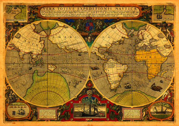
A sixteenth-century, double-hemisphere map of the world, showing the routes and circumnavigations of Sir Francis Drake between 1577 and 1580, and of Thomas Cavendish between 1586 and 1588. Drake was the second explorer after Magellan to complete a circumnavigation of the globe and Cavendish was the third. Cavendish, a privateer, set out on a plundering trip around the world and returned to England two years later draped in silk and Spanish gold. The map was originally published in 1595 by the famed Dutch engraver and cartographer Jodocus Hondius. This elaborate work of art features vignettes and insets with text and illustrations alongside the margins. Two ancillary maps show Drake’s landing at California (Portus Novae Albionis) and Java, and two other ancillary views depict Drake's welcome at the Moluccas and his ship the Golden Hind cast up on the rocks near the Celebes (Sulawesi). Map title: Vera Totius Expeditionis Nauticae... (Vera Totivs Expeditionis Navticæ…).
• 16th-century world map depicting Sir Francis Drake’s World Expeditions
• Fine Art Premium Giclée (Gouttelette) Print (100% cotton 340 gsm fine art paper)
• Made in USA/p>


