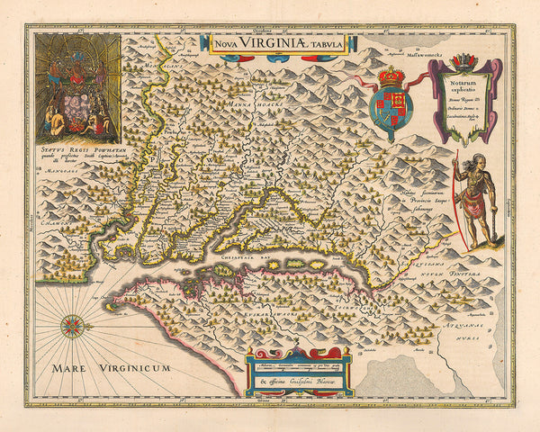
Nova Virginia Tabula, originally simply titled “Virginia”, is the most detailed and comprehensive early map of the Chesapeake region. Compiled by Captain John Smith in 1608, and engraved and first printed in 1612, the famous map was later published in 1624 in Smith’s book The Generall Historie of Virginia, New-England, and the Summer Isles. In the following decades, the map sees numerous translations and editions, including such from the preeminent map houses in Europe. The current copy is a beautiful full-color rendition of the Joan and Cornelius Blaeu’s 1640 issue of the Virginia map.
• Captain John Smith’s map of the Chesapeake Bay area, Nova Virginiae Tabula (Nova Virginiae Tabvla)
• Title: Nova Virginiæ Tabula, 1640 (1608), Blaeu Publishing House, Amsterdam
• Fine Art Premium Giclée (Gouttelette) Print (100% cotton 340 gsm fine art paper)
• Made in USA


