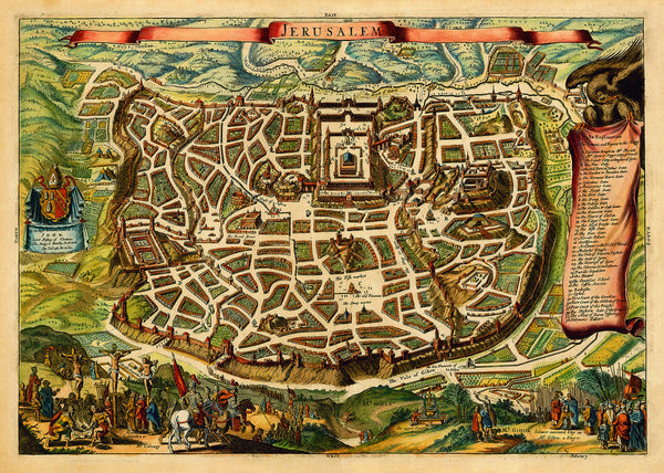
An English version of Nicolas Visscher’s famous biblical illustration map, “The Holy Walled City of Jerusalem, first known as Salem”*. This is the English language edition from 1671, prepared by Joseph Moxon for the bishop of Cheshire, and titled simply and quite fittingly, “Jerusalem”. This bird’s-eye view/plan of Ancient Jerusalem shows the city’s streets, markets and surrounding walls, as described in the Scriptures, featuring numerous Biblical sites with a key on the right — Temple Mount and the Second Temple, Herod’s Castle, Solomon's Palace, the Mount of Olives, the Garden of Gethsemane, the Pool of Bethesda, Mount Calvary (Golgotha) with Jesus on the cross, the Holy Sepulchre of Christ, Kidron Valley, Mount Gihon with King Solomon’s Annointment, etc. (*For reference, please see another item of ours, Jerusalem in Biblical Times, Visscher, 1643, Antique Map.)
• Ancient Map of Jerusalem in Biblical Times, 1600s, English Language Edition
• Fine Art Premium Giclée (Gouttelette) Print (100% cotton 340 gsm fine art paper)
• Made in USA


