Home
Gallery
−
American History
+
Colonial Period
Revolutionary War
Westward Expansion
Civil War
WWI
WWII
World
+
World Maps
Africa
America
+
Caribbean & Central America
North America
South America
The Americas
Asia
Europe
Oceania
Cities
+
New York
London
Paris
Jerusalem + Holy Land
Bird’s-Eye Views
Sets of Cities
Pictorial Maps
Wall Art Sets
+
Framed Sets
Unframed Sets
Blog
About
Contact
Gift Certificates
←
Europe / American history
Share this:
Tweet
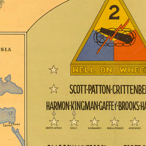
2nd Armored Division Commemorative Map
from
→
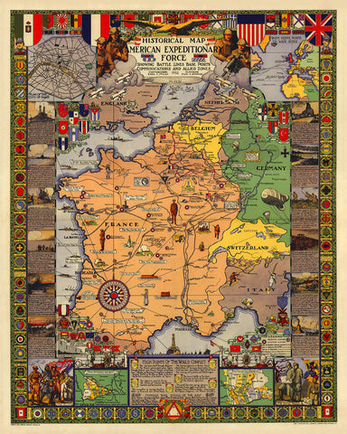
American Expeditionary Force in Europe, WWI Historical Map
→
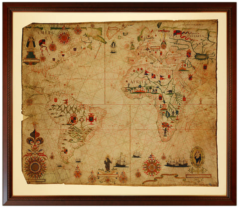
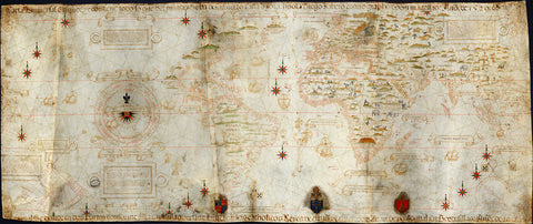
Atlantic Ocean, 1633, America, Africa, Europe, Portolan Chart
→
Battle of Britain, 1940, Kent, England, WWII Pictorial Map
→
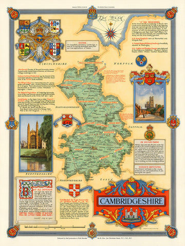
Cambridgeshire, England, WWII Era Map
→
Europe, 1914-1918, Western Front, Vintage WWI Map
→
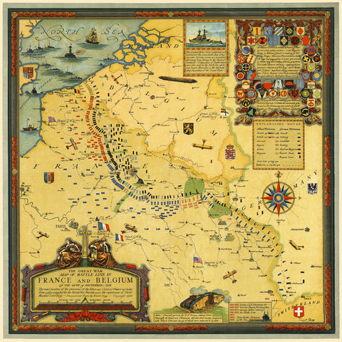
Europe, 1918, France, Belgium, Western Front, WWI Map
→
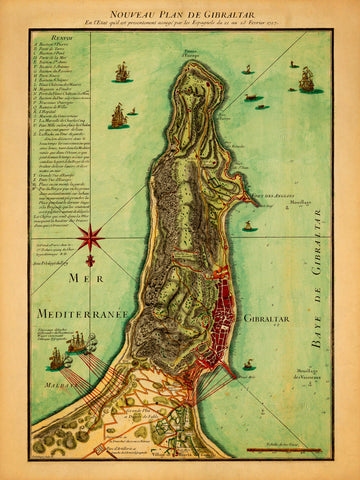
Gibraltar, 1727, Nouveau Plan, Siege, Anglo-Spanish War, Antique Map
from
→
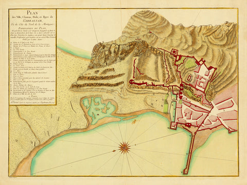
Gibraltar, 1779, Great Siege of Gibraltar, Plan, Old Map
from
→
I Want You For U.S. Army, 1917, WWI Uncle Sam Poster, Flagg
→
London, 1914, Wonderground Map, MacDonald Gill
from
→
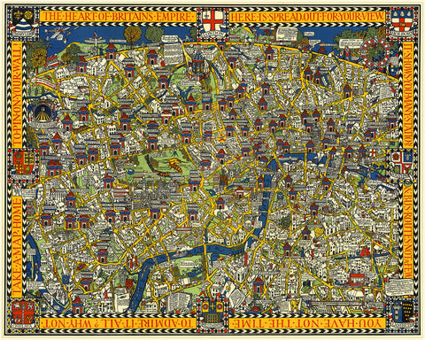
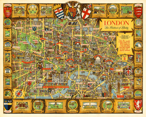
London, Bastion of Liberty, Vintage Pictorial Map
→
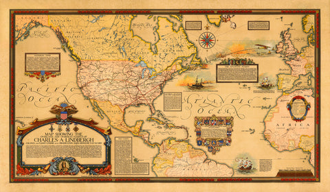
North America & Atlantic, 1928, Charles Lindbergh’s Flights, Commemorative Map
→
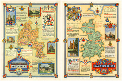
Oxford & Cambridge, England, Map Set
→
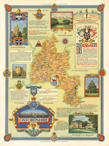
Oxfordshire, England, WWII Era Map
→
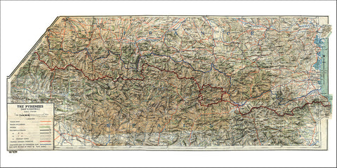
Pyrenees, 1943, France Spain Border, WWII Cloth Map
→
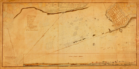
Tripoli, 1804, Battle of Tripoli Harbor, Barbary Wars, US Navy, USMC, Plan & View
→
World, 1529, Planisphere, Carta Universal, Padrón Real, Ribeiro, “Propaganda Map”
from
→
World, 1630, Hondius, Nova Totius Terrarum Orbis, Antique Map
→
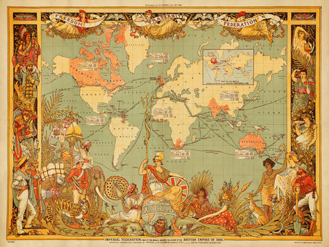
World, 1886, British Empire, Imperial Federation, Walter Crane, Vintage Map
→
top