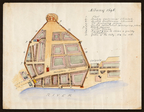
A map of Albany, New York in 1695, hand drawn in watercolor and ink by James Eights, after John Miller. The plan shows Fort Albany with the palisades (stockadoes) encircling the town, and a key to the locations and buildings included on the map, e.g., “Dutch Calvinist Church”, “Dutch Lutheran Church”, “Block Houses”, “Stadt House”, etc. Eights probably drew the plan around 1850. (The map is printed on an easy-to-frame, standard 8.5” x 11” size sheet of watercolor textured fine art paper.)
• Albany, New York, and Fort Albany, in 1695, manuscript plan by James Eights after John Miller
• Fine Art Premium Giclée (Gouttelette) Print (100% cotton watercolor textured fine art paper)
• Made in USA


